With Google Earth Pro we can model and visualise developers’ scheme

1 min read

Author: Cyril Richert

After 10 years, Google has decided to make Google Earth Pro available for free. The Pro version has much more robust geospatial tools that are especially useful to architects.

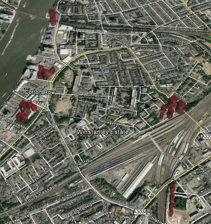
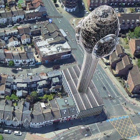
More specifically the Pro version can measure and draw distances/areas using lines, paths, polygons, circles, and more. We can now simulate any building to get a “real” view of what it would look like in a specific are (and not rely on so called “verified” view provided by the developers).

You can see an example with the video below:

Thanks to Google Earth, it is now easier to visualise some planning applications in breach of Wandsworth planning documents around Clapham Junction but already approved, recommended for approval or considered favourably by Wandsworth Council.

In red, towers approved,  recommended for approval or considered appropriate by Wandsworth Council
In red, towers approved, recommended for approval or considered appropriate by Wandsworth Council

Do you think what we are doing is helping the community and you want to encourage us to do more?

Your help means we can spend more time researching stories, talking to contacts, sitting through meetings and writing stories. Any money given will support community and public interest news and the expansion of our coverage in area of Clapham Junction. Battersea, Wandsworth and around.

Support us, help us to expand: subscribe to CJI with a monthly donation

Donate

Monthly amount needed to make it sustainable:

We'd be interested to hear what kind of articles you would like to see more of on the site – send your suggestions to the editor.

CJI editor and Clapham Junction Action Group co-founder and coordinator since 2008, Cyril has lived in Clapham Junction since 2001.
He is also funder and CEO of Habilis-Digital Ltd, a digital agency creating and managing websites and Internet solutions.